Quick
One afternoon
Falls and trail
See the day tripGuides
Language
Currency
Check open spotsfrom $53 · no cancel feeLook up your stop
Find out about 20 stops
Pick a route and tap a pin or a stop: you get its note and a Google Maps link.
MBK Center in Bangkok, where the day trip lists its meeting point on the ground floor.
Google MapsThe JEATH War Museum in Kanchanaburi town, the first stop of the day trip after the drive from Bangkok.
Google MapsThe Bridge on the River Kwai in Kanchanaburi town, one stop of the home tour on the way to the park.
Google MapsThe falls and the start of the trail, in the east of the park near the headquarters.
Google Maps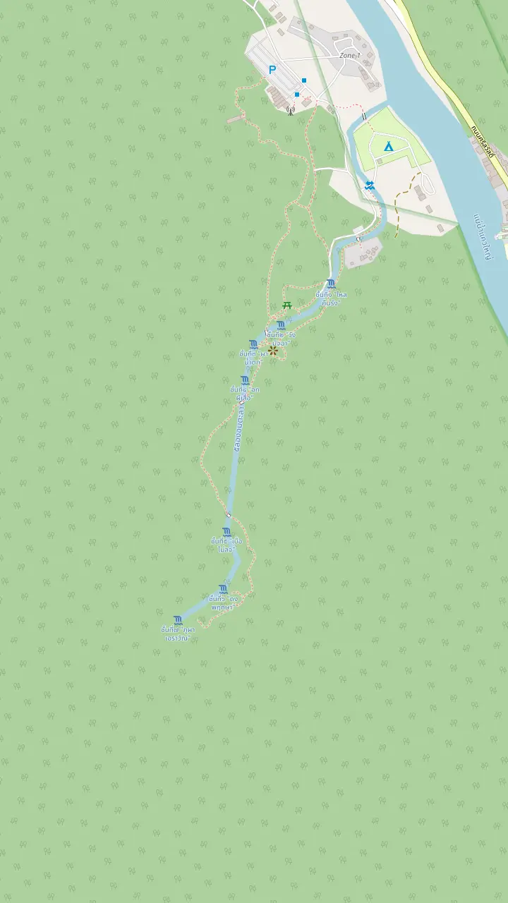
The lowest pool of the staircase, nearest to the start of the path.
Google MapsThe park authority picks this tier for its water sliding down a rock slope; the nature trail starts here.
Google MapsA pool on the way up, where the path begins to leave the busiest water behind.
Google MapsA middle pool of the staircase, in forest shade.
Google MapsDescribed by the authority as a big, cool pool with rocks polished over a long time.
Google MapsA pool below the summit, a place to rest before the last climb.
Google MapsThe top: a rock here looks like the head of the elephant Erawan.
Google Maps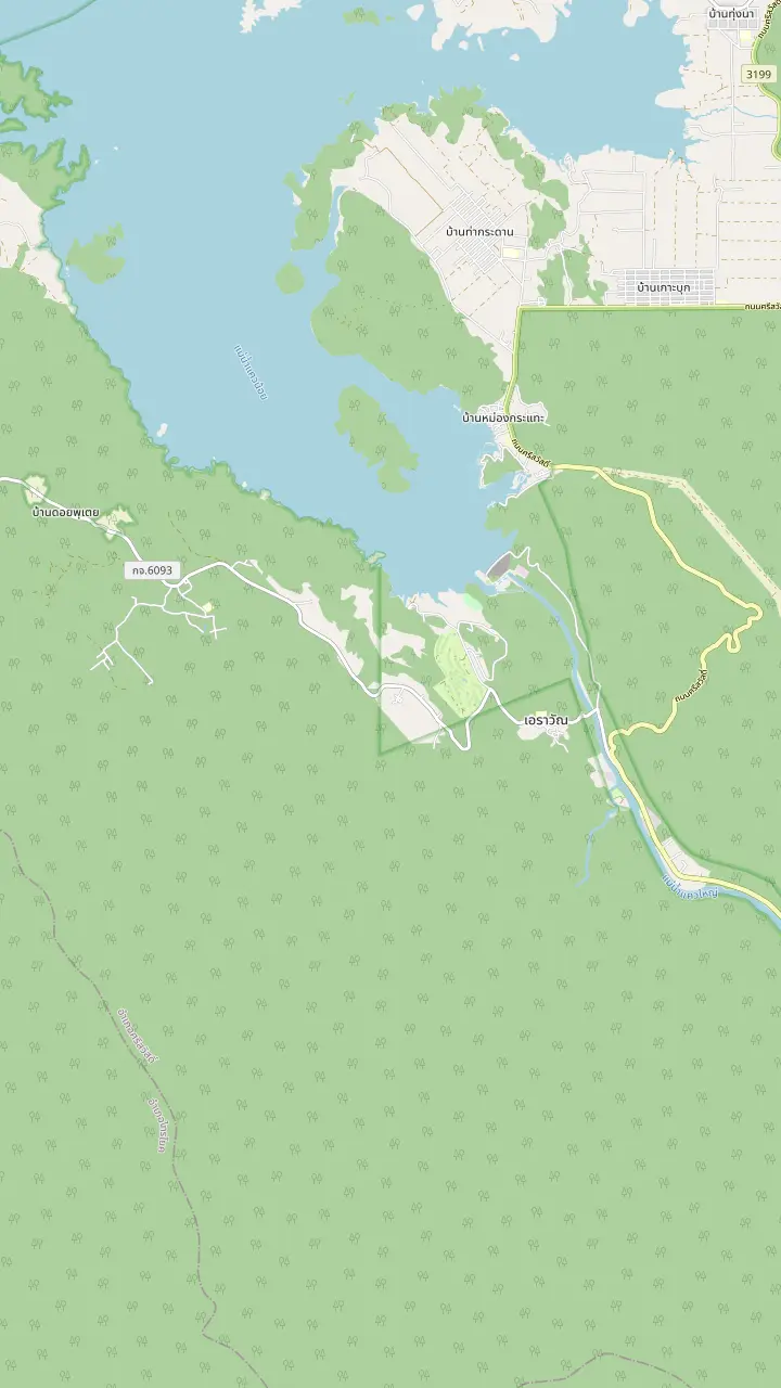
The map point named Erawan National Park, north of the falls; the park office answers on 034-574-222.
Google MapsThe falls and the start of the trail, in the east of the park near the headquarters.
Google MapsPhra That Cave, which the park authority shows with curtains of stalactites.
Google MapsThe Srinagarind Dam, on the same road as the park.
Google Maps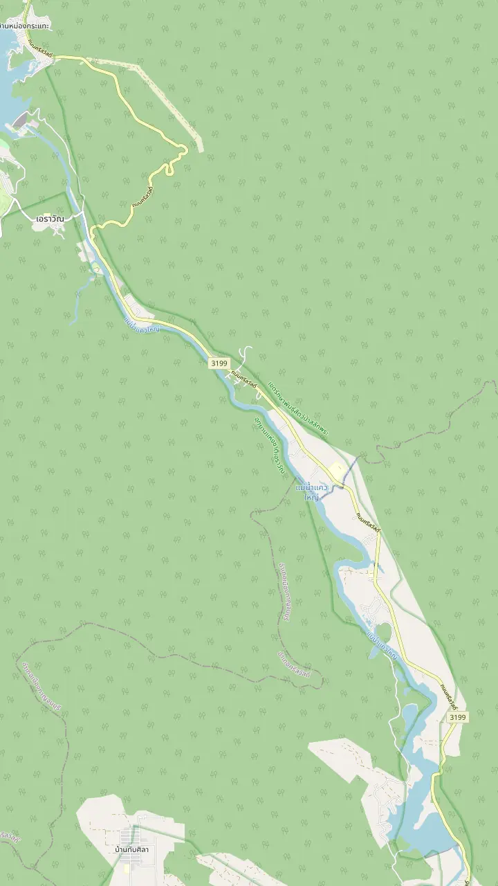
The falls and the start of the trail, in the east of the park near the headquarters.
Google MapsA hotel near the falls on the map, shown only to place lodging near the entrance.
Google MapsA small lodging north of the falls, on the way to the dam.
Google MapsA raft-room resort on the Kwae Yai river listed by the Department of Tourism, with breakfast and activities included.
Google MapsA camping ground beside the River Kwai in Chong Sadao, listed by the Department of Tourism.
Google MapsMaps © OpenStreetMap contributors
Most visitors see one waterfall and leave. This guide places the whole park on the map, explains its size and its name, and lists what else the authorities and the tourism board point to inside and around it.
Editorial team, erawanwaterfalltour.quest · Updated November 12, 2026 · Quick read: 7 min
Summary view
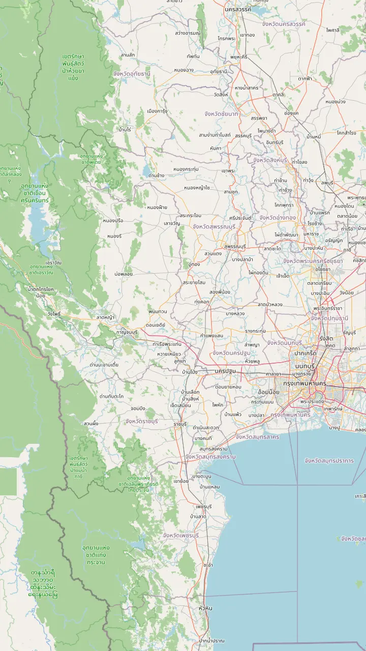
Erawan National Park lies in the west of Thailand, in Kanchanaburi province. The Department of National Parks places it across three districts: Mueang, Si Sawat and Sai Yok.1 The Tourism Authority of Thailand adds a useful pointer for anyone looking at a road map: the park is in Si Sawat district, off Highway 3199, the same road that leads to the Srinakarin Dam.5 Those two details already describe most of the Erawan waterfall location, a long way from the coast and in the hills behind the reservoir.
Two official sources measure the last stretch a little differently. Starting from Kanchanaburi town and following highway 3199, across the bridge to the Erawan municipal market and on to the park headquarters, the park authority gives 66 kilometres in all.6 The tourism directory gives about 70 kilometres from downtown Kanchanaburi by the same road past the dam and its market.7 Treat the gap as rounding and starting points, and allow for the road rather than for the arithmetic.
Inside the park the layout is simple. The falls are in the east, close to the park headquarters,8 which makes the headquarters area the natural reference point for the whole visit. Everything else on this page, from caves to boat rides, is described in relation to that spot. Kanchanaburi itself, the TAT notes, is about an hour and a half by car, heading west from Bangkok.9 The page on getting there covers buses, trains and tours in detail.
Inside and around
| Place | What the source says | Where it comes from |
|---|---|---|
| The falls | Tiers with a pool at each level17 | Tourism directory |
| Nature trail | A signed walk at tier 212 | Park authority |
| Phra That Cave | Stalactites, a destination for adventurous visitors13 | TAT |
| Khwae river | Rubber-boat paddling on a rest day18 | Park authority |
| Srinakarin Dam | On the same highway as the park5 | TAT |
| Huai Khamin | A seven-tiered waterfall in the neighbouring park19 | TAT |
Each row is a line from an official source; none is a distance or a price.13
The numbers show a larger place than most photographs suggest. The park authority says Erawan became Thailand's 12th national park on 19 June 1975 and that it covers about 549.98 square kilometres.2 TAT's older newsroom feature rounds the area to about 600 square kilometres,14 which is a looser figure of the same landscape. Neither number comes close to describing what a day-tripper sees, because the falls occupy a tiny corner of the total.
That corner sits inside something much bigger. The authority describes Erawan as one of the conservation areas within the western forest of Thailand, a block of more than 18,720 square kilometres whose core is formed by the Huai Kha Khaeng and Thung Yai Naresuan World Heritage forests.15 The park is therefore a neighbour of some of the most valued wildland in the country, and that context explains why rangers here talk about tigers and elephants and not only about swimmers.
Popularity is measurable too. In the fiscal year 2025 the national parks department ranked Erawan 8th among all national parks by income from entrance fees.16 The ranking says nothing about quality, but it does say that many people come. Plan for company at the pools, and look for the quieter corners the other sections of this page describe, where the park keeps the room it has, away from the busiest water.
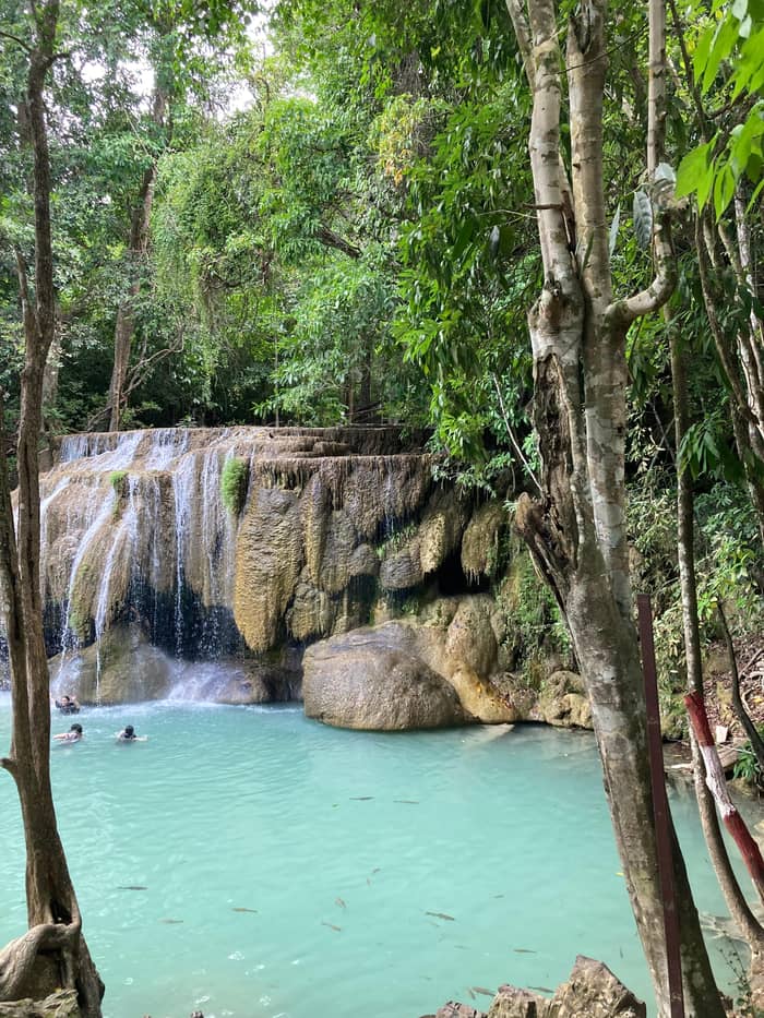
The park takes its name from its best-known waterfall, and the waterfall takes its name from a rock. On the top tier a stone above the water resembles an elephant's head, the Erawan of the name.3 It is a pleasing little detail to carry up the path, because the resemblance is easier to see when you know what to look for and when the water is running well. Take a moment at the top, before the walk down, to look back along the staircase of pools you have just climbed.
The elephant is the newer name. The authority gives the early name of the falls as Sa Dong Mong Lai, from the Mong Lai stream that has its source on Ta Mong Lai peak.23 The tourism directory also names the creek as the source of the water, flowing through the mountain and the cliff.17 So the geography is older than the legend: a stream, a peak, a limestone staircase, and only later an elephant to label them.
If a page elsewhere sends you to the park for its mythology, remember that the park authority's own wording is practical. It describes rock shapes, water volume and where visitors can walk, and leaves the storytelling to the visitor. That is a good habit to adopt on the trail itself: look at the stones, listen to the water, and let the name come to you rather than expecting a sign to explain it.
Choose your time
Match the time you have to the sources' own suggestions.
If I have an afternoon
The falls and the signed trail
The nature trail of 1 kilometre is a short walk beside the pools.12
If I want something quieter
Phra That Cave
TAT points adventurous visitors to the cave and lesser-known waterfalls.13
If I like birds and small things
The forest edge by the falls
The department's pictures show a flowerpecker and red mushrooms by the water.20,21
If I want a gentler water day
The Khwae river
Paddling a rubber boat is described as relaxed.18
If I am travelling in the dry hot months
A day with a closure check
Fires and haze closed the park once in April 2026.10
How long to stay
Quick
Falls and trail
See the day trip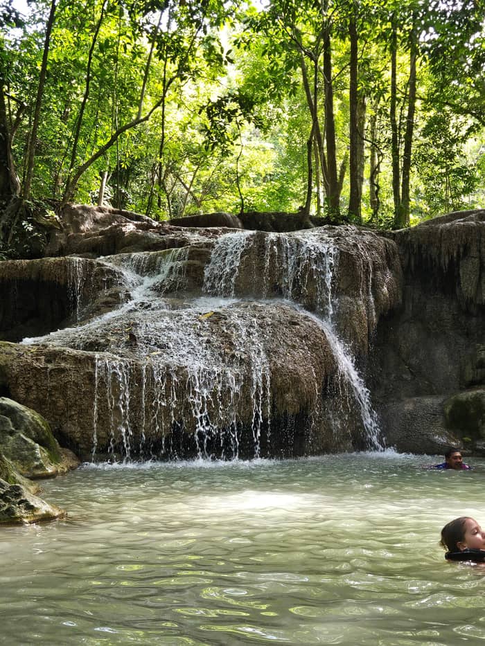
Fuller
Falls and cave
See the day trip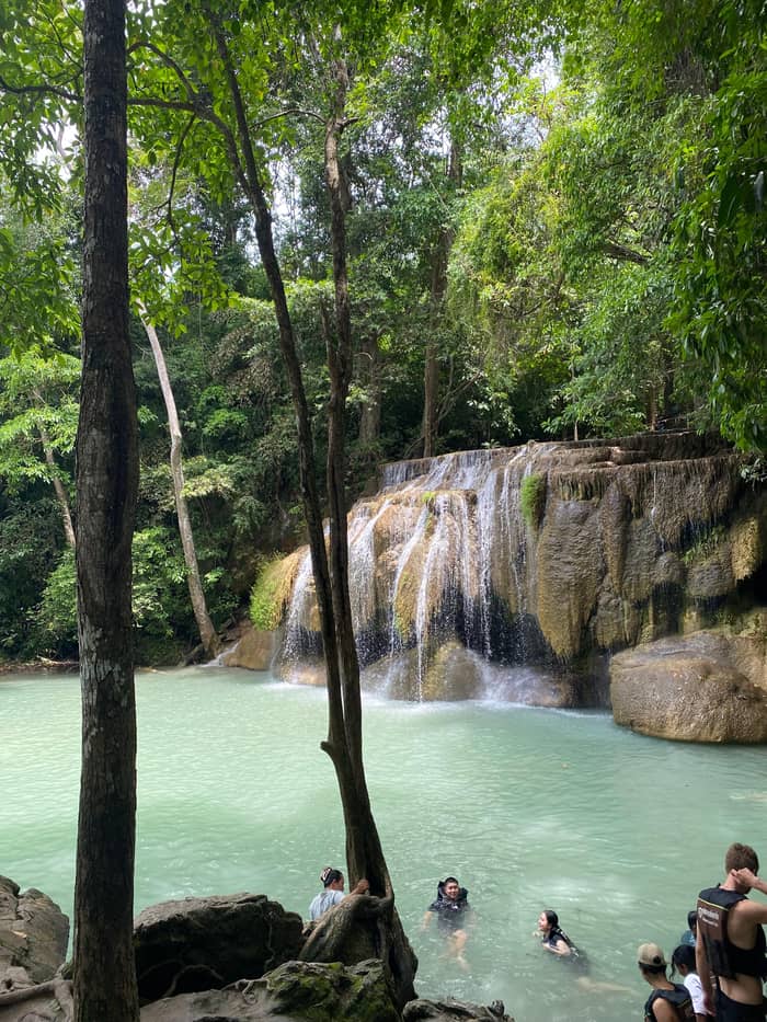
Slow
Park and river
See the day tripPeople searching for things to do in Erawan National Park usually find only swimming, but the authority's own material lists more. A trail of 1 kilometre at tier 2 comes with information boards.12 That is a modest walk and an easy one to add if the pools are crowded, since it turns a swimming stop into a short lesson in the forest around it. Walk it slowly, read the signs and let the children, if any, set the pace.
Deeper in the park, TAT says, fewer people venture out to the hidden corners: adventurous visitors can trek to waterfalls few people know, or enter Phra That Cave with its stalactites and stalagmites.13 The department shows the same cave with curtains of stalactites and describes it as among the best-known in the land.26 Both sources treat the cave as a real destination, so a visitor with a free half-day should consider it before adding another swim.
The park also rewards people who look closely. The department's pictures include a flowerpecker with an orange belly, a tiny bird,20 bright red champagne mushrooms that are not hard to find along the water at the falls,21 and cave crickets in the dark of the caves.31 For an activity on the water the department mentions paddling a rubber boat on the Khwae river as a relaxed way to spend a rest day.18
Two days around the park
Arrival day
Overnight stays at the park have been offered, and riverside lodging exists nearby.10
Late afternoon
Drive the highway to the reservoir and the dam that TAT names.5
Next morning
Be at the falls when the park opens at 7.30.11
Midday
A short signed walk of 1 kilometre at tier 2.12
Afternoon
The cave TAT recommends for adventurous visitors.13
Before closing
The directory lists closing at 16.00.11
The road to the park is itself part of the trip. TAT describes it as the Highway 3199 that leads on to the Srinakarin Dam,5 and the dam is a short detour for anyone interested in the reservoir that shapes this corner of Kanchanaburi. Visitors who like to camp can note TAT's suggestion of Khuean Srinagarindra National Park, where campers can see the stars and the seven-tiered Huai Khamin Waterfall.19
Adventure seekers should read what TAT says about the Lam Klong Ngu route: a rainforest trek with hiking, climbing, floating, waterfall jumping and cave exploration that can take up to two days.32 It is a different league from the pools at Erawan and belongs on a separate trip. For a quieter night, TAT also mentions raft houses floating on the Khwae Noi at Sai Yok National Park, with no electricity and lantern light only.33
The small-group day trip sold on this site pairs the park with two Kanchanaburi town stops, a wartime museum and the famous bridge, on a long day of 12 to 14 hours. The newsroom reminds readers that Kanchanaburi is often associated with that bridge and the wartime railway.34 Those places belong to the wider story of the province, and they make the drive worth the time, whichever way you travel.
Video
Jah Marsh on YouTube · The video waits until you tap play to load.
fewer people venture deep into the park to explore its hidden gems. Adventurous travellers can trek to lesser-known waterfalls or visit the Phra That Cave
Before you set off
A single afternoon is enough for the falls and one extra stop. The directory has the falls open at 7.30 and closed at 16.00 daily,11 so plan to arrive early and leave before closing. With that window, a visitor can climb to the pools, walk the nature trail and still have time for a rest by the water. The tour listing allows 1 hour at the park plus another 1 for hiking and swimming.
Two days suit a visitor who wants the cave, the quieter trails and the river as well. The park has had overnight stays at times: when it closed on 21 April 2026 because of forest fires and haze, the closure covered tourism and overnight stays,10 and the park reopened both from 22 April 2026.35 The page on where to stay lists what the sources say about sleeping near the park, and a day trip can still be added around any night you spend.
Before you go, check the park's situation. The fine dust average that prompted the April closure reached 42.9 micrograms per cubic metre,36 a reminder that dry-season haze can close a park at short notice. The park office answers on 034-574-222, and the park keeps a Facebook page that it says is updated around the clock.4 TAT also wants visitors to read each park's rules ahead of the trip.29
FAQ
It was the 12th national park in Thailand, according to the park authority.2
The office answers on 034-574-222 and the park runs a Facebook page updated around the clock.4
The name comes from the elephant Erawan, whose head a rock on the top tier resembles.3
Sources
Further reading
Planning a day at Erawan Falls? Ask a real person here.